About KY PowerMap
Generation Fuel Mix Chart! You can now see a breakdown of all the fuel sources used to generate our power. Created for Kentucky’s Touchstone Energy Cooperatives to provide cutting edge resources for economic developers...
Generation Fuel Mix Chart! You can now see a breakdown of all the fuel sources used to generate our power.
Created for Kentucky’s Touchstone Energy Cooperatives to provide cutting edge resources for economic developers around the world looking to locate industrial projects in sites with some of the lowest electric rates in the country. The first of its kind, PowerMap puts the power of locational knowledge in your hand with detailed co-operative service territory maps for all of our 87 counties served by the Kentucky Touchstone Energy Cooperatives. Type in an address or use your mobile device’s GPS capabilities to determine if you are in one of our 16 cooperatives' service territories. PowerMap leverages over 63,000 site selection data points from StateBook International, the premier data site for economic development site selectors (www.StateBook.com ) to locate the perfect location for your next great economic development project. Use the app to access geo-specific data such as: availability of skills, detailed workforce data, available sites and buildings, quality of life attributes, along with narratives and facts about the community and region. Visit www.DataIsPower.org for more information about PowerMap including the PowerMap web application and other initiatives being implemented by the Kentucky Touchstone Energy Cooperatives to make Kentucky the logical choice for your next economic development project.
Features:
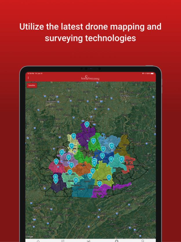
• Detailed cooperative service territory maps for all of our 87 counties served by the Kentucky Touchstone Energy Cooperatives
• Type in an address or use your mobile device’s GPS capabilities to determine if you are in one of the 16 Kentucky Touchstone Energy Cooperatives
• Access over 63,000 of the most recent site selection data points leveraged through StateBook International, the premier data site for economic development site selectors www.StateBook.com
• Locate building sites and available buildings for potential economic development opportunities in some of the lowest energy costs regions of the country
• Determine service territory information whether you have a cell signal or not
• Conceived by and built for Economic Developers to access pertinent data in the quickest time frame
• Part of the suite of economic development efforts by the Kentucky Touchstone Energy Cooperatives
Dec 6, 2022
Version 5.0.0
User Interface updates and new StateBook functionality.
Previous Versions
Here you can find the changelog of KY PowerMap since it was posted on our website on 2023-09-06 19:09:46.
The latest version is 5.0.0 and it was updated on 2024-04-22 19:00:18. See below the changes in each version.
KY PowerMap version 5.0.0
Updated At: 2022-12-06
Changes: Dec 6, 2022
Version 5.0.0
User Interface updates and new StateBook functionality.
Disclaimer
Official App Store Link
We do not host KY PowerMap on our servers. We did not scan it for viruses, adware, spyware or other type of malware. This app is hosted by Apple and passed their terms and conditions to be listed there. We recommend caution when installing it.
The App Store link for KY PowerMap is provided to you by apps112.com without any warranties, representations or guarantees of any kind, so access it at your own risk.
If you have questions regarding this particular app contact the publisher directly. For questions about the functionalities of apps112.com contact us.